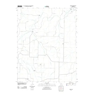
2011 Map of Rader
USGS Topo · Published 2011About this map
The Osage Fork Gasconde River winds through this section of Laclede County, defining a landscape shaped by narrow hollows and numerous creek branches. Small rural settlements like Pease, Rader, and Susanna are connected by a network of local routes such as Highway ZZ and Auburn Rd. The area’s water management and recreation are visible through features like the Lehar Lake Dam and the A J Shrubar Dam on the Myers Branch.
Find a feature on this map
53 named features on this map. Tap any name to fly to it.
Don’t see what you’re looking for? This feature index may not catch every label — zoom into the map to look around manually.
Map Details
Editions of this 2011 Rader Map
This is the sole edition of this map. No revisions or reprints were ever made.
Other maps of this area

1939 · Long Lane
USGS Topo · 1:62,500

1941 · Lebanon
USGS Topo · 1:62,500

1942 · Long Lane
USGS Topo · 1:62,500

1943 · Lebanon
USGS Topo · 1:62,500

1946 · Niangua
USGS Topo · 1:62,500

1948 · Niangua
USGS Topo · 1:62,500

1954 · Springfield
USGS Topo · 1:250,000

1956 · Duncan
USGS Topo · 1:24,000

1956 · Rader
USGS Topo · 1:24,000
1956 · Hartville
USGS Topo · 1:24,000