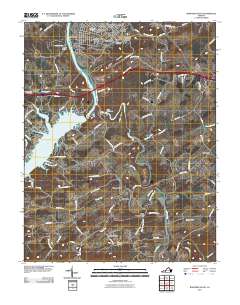
2011 Map of Radford South
USGS Topo · Published 2011About this map
Claytor Lake and its impounded waters dominate this landscape south of Radford, where the New River meets the Little River. The topography is defined by the engineering of the Claytor Dam and the smaller Little River Dam, which restructured the local hydrology and created a recreational and residential hub. North of the lake, the city of Radford expands into planned neighborhoods like Radford Village, Highland Hills, and Smithfield.
Find a feature on this map
93 named features on this map. Tap any name to fly to it.
Don’t see what you’re looking for? This feature index may not catch every label — zoom into the map to look around manually.
Map Details
Editions of this 2011 Radford South Map
This is the sole edition of this map. No revisions or reprints were ever made.
Other maps of this area

1889 · Hillsville
USGS Topo · 1:125,000

1890 · Dublin
USGS Topo · 1:125,000

1890 · Christiansburg
USGS Topo · 1:125,000

1891 · Dublin
USGS Topo · 1:125,000

1892 · Hillsville
USGS Topo · 1:125,000

1896 · Hillsville
USGS Topo · 1:125,000

1932 · Blacksburg
USGS Topo · 1:48,000

1937 · Blacksburg
USGS Topo · 1:62,500

1950 · Radford
USGS Topo · 1:62,500

1953 · Winston-Salem
USGS Topo · 1:250,000