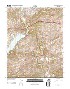
2013 Map of Radford South
USGS Topo · Published 2013About this map
Snowville and Graysontown anchor the southern reaches of this landscape, where the meandering Little River flows toward its confluence with the New River near the Ingles Ferry Bridge. The northern portion of the map is defined by the denser suburban expansion of Smithfield, Sunset Village, and Highland Hills, reflecting the residential growth surrounding the regional hub. In contrast, the southern and eastern sectors remain largely rural, marked by smaller named settlements like Simpkinstown and Childress. A significant geographic feature is the eastern arm of Claytor Lake, which stretches into the rugged terrain near Ingles Mountain. For those studying local history, the map preserves the exact layout of historic hollows and creeks, such as Hazel Hollow and Connellys Run, which have shaped the settlement patterns of this Virginia river valley for generations.
Find a feature on this map
146 named features on this map. Tap any name to fly to it.
Don’t see what you’re looking for? This feature index may not catch every label — zoom into the map to look around manually.
Map Details
Editions of this 2013 Radford South Map
This is the sole edition of this map. No revisions or reprints were ever made.
Other maps of this area

1889 · Hillsville
USGS Topo · 1:125,000

1890 · Dublin
USGS Topo · 1:125,000

1890 · Christiansburg
USGS Topo · 1:125,000

1891 · Dublin
USGS Topo · 1:125,000

1892 · Hillsville
USGS Topo · 1:125,000

1896 · Hillsville
USGS Topo · 1:125,000

1932 · Blacksburg
USGS Topo · 1:48,000

1937 · Blacksburg
USGS Topo · 1:62,500

1950 · Radford
USGS Topo · 1:62,500

1953 · Winston-Salem
USGS Topo · 1:250,000