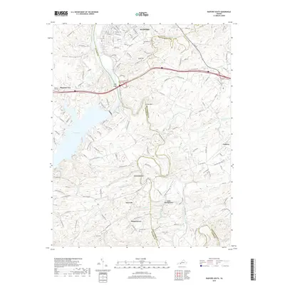
2019 Map of Radford South
USGS Topo · Published 2019About this map
The New River carves a deep path through this Montgomery and Pulaski County landscape, defining the character of local settlement and industry. Near the crossing at Ingles Ferry Bridge, the terrain rises toward the prominent heights of Ingles Mtn. To the west, the massive expanse of Claytor Lake dominates the topography, while the winding Little River meanders northward to join the main channel.
Find a feature on this map
129 named features on this map. Tap any name to fly to it.
Don’t see what you’re looking for? This feature index may not catch every label — zoom into the map to look around manually.
Map Details
Editions of this 2019 Radford South Map
This is the sole edition of this map. No revisions or reprints were ever made.
Other maps of this area

1889 · Hillsville
USGS Topo · 1:125,000

1890 · Dublin
USGS Topo · 1:125,000

1890 · Christiansburg
USGS Topo · 1:125,000

1891 · Dublin
USGS Topo · 1:125,000

1892 · Hillsville
USGS Topo · 1:125,000

1896 · Hillsville
USGS Topo · 1:125,000

1932 · Blacksburg
USGS Topo · 1:48,000

1937 · Blacksburg
USGS Topo · 1:62,500

1950 · Radford
USGS Topo · 1:62,500

1953 · Winston-Salem
USGS Topo · 1:250,000