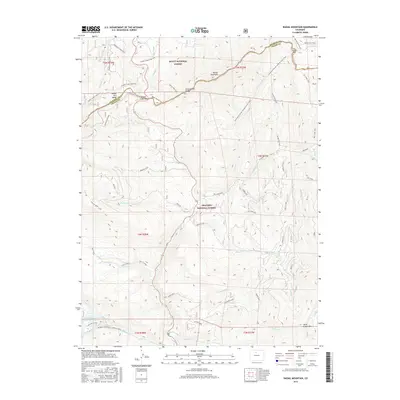
2016 Map of Radial Mountain
USGS Topo · Published 2016About this map
The Rabbit Ears Range forms a prominent high-altitude spine across this landscape, where the Continental Divide winds between the Routt National Forest and Arapaho National Forest. The map documents a complex network of resource and recreational paths, from the Illinois Ditch Trail to the high-elevation Continental Divide National Scenic Trail. Evidence of the area's mineral prospects appears at the Parkview Mtn Mine, situated near the headwaters of Parkview Cr. Significant travel corridors like Willow Creek Pass provide access through the mountain terrain, while features like the Little King Ranch Reservoir indicate human land use and water management in the valleys. This 2016 survey captures the intersection of Jackson and Grand counties amidst peaks like Radial Mountain and Gravel Mtn.
Find a feature on this map
54 named features on this map. Tap any name to fly to it.
Don’t see what you’re looking for? This feature index may not catch every label — zoom into the map to look around manually.
Map Details
Editions of this 2016 Radial Mountain Map
This is the sole edition of this map. No revisions or reprints were ever made.
Other maps of this area

1915 · Longs Peak
USGS Topo · 1:125,000

1919 · Rocky Mountain National Park
USGS Topo · 1:125,000

1954 · Greeley
USGS Topo · 1:250,000

1954 · Craig
USGS Topo · 1:250,000

1956 · Radial Mountain
USGS Topo · 1:24,000

1956 · Jack Creek Ranch
USGS Topo · 1:24,000

1956 · Parkview Mountain
USGS Topo · 1:24,000

1956 · Rand
USGS Topo · 1:24,000

1956 · Rand
USGS Topo · 1:62,500

1957 · Craig
USGS Topo · 1:250,000