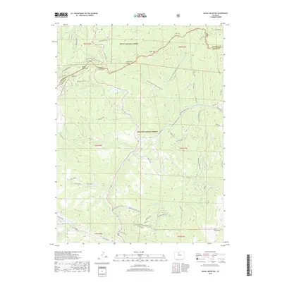
2019 Map of Radial Mountain
USGS Topo · Published 2019About this map
Rabbit Ears Range and the high ridgelines of the Continental Divide dominate this landscape along the border of Grand and Jackson counties. The terrain is defined by its deep alpine drainage systems, including Willow Cr and Kauffman Creek, which flow through the protected lands of Routt National Forest and Arapaho National Forest. High-altitude mobility is central to the area's layout, centered on Willow Creek Pass and a network of technical routes like Stillwater Pass and the Snyder Creek Loop. Evidence of high-country industry and recreation appears at the Parkview Mtn Mine and the Denver Creek CG. The map also highlights the Continental Divide National Scenic Trail, winding past landmarks like Top of the World and Radial Mtn, providing a precise record of late 20th-century trail systems and natural resources.
Find a feature on this map
49 named features on this map. Tap any name to fly to it.
Don’t see what you’re looking for? This feature index may not catch every label — zoom into the map to look around manually.
Map Details
Editions of this 2019 Radial Mountain Map
This is the sole edition of this map. No revisions or reprints were ever made.
Other maps of this area

1915 · Longs Peak
USGS Topo · 1:125,000

1919 · Rocky Mountain National Park
USGS Topo · 1:125,000

1954 · Greeley
USGS Topo · 1:250,000

1954 · Craig
USGS Topo · 1:250,000

1956 · Radial Mountain
USGS Topo · 1:24,000

1956 · Jack Creek Ranch
USGS Topo · 1:24,000

1956 · Parkview Mountain
USGS Topo · 1:24,000

1956 · Rand
USGS Topo · 1:24,000

1956 · Rand
USGS Topo · 1:62,500

1957 · Craig
USGS Topo · 1:250,000