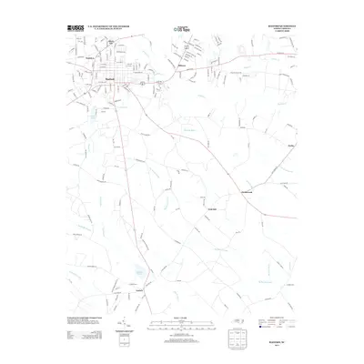
2013 Map of Raeford
USGS Topo · Published 2013About this map
The town of Raeford serves as the central hub of this Hoke County landscape, where the street grid transitions into a network of rural roads and expansive wetlands. To the southeast, small settlements like Dundarrach and Arabia are scattered among the significant drainage systems of Big Marsh Swamp and Little Marsh Swamp. The map documents a blend of residential growth and agriculture, evidenced by newer developments like Hillcrest and the longstanding agricultural presence at Gibson Farms. Hydrology dominates the terrain, with Rockfish Cr and Raft Swamp carving through the area, influencing the placement of local infrastructure. For those researching family history, the inclusion of Scurlock School Rd and names like McNeills Mill Cr provides clues to earlier community centers and local industry in the early 21st century.
Find a feature on this map
182 named features on this map. Tap any name to fly to it.
Don’t see what you’re looking for? This feature index may not catch every label — zoom into the map to look around manually.
Map Details
Editions of this 2013 Raeford Map
This is the sole edition of this map. No revisions or reprints were ever made.
Other maps of this area

1948 · Southern Pines
USGS Topo · 1:62,500

1948 · Clifdale
USGS Topo · 1:62,500

1948 · Nicholson Creek
USGS Topo · 1:24,000

1948 · Clifdale
USGS Topo · 1:24,000

1948 · Mc Cain
USGS Topo · 1:24,000

1949 · Wagram
USGS Topo · 1:24,000

1949 · Wakulla
USGS Topo · 1:24,000

1949 · Laurinburg
USGS Topo · 1:62,500

1950 · Clifdale
USGS Topo · 1:24,000

1950 · Sanatorium
USGS Topo · 1:24,000