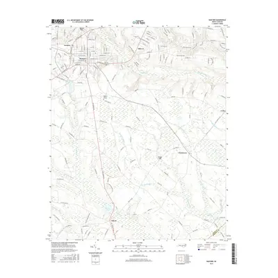
2016 Map of Raeford
USGS Topo · Published 2016About this map
The town of Raeford serves as a central hub in this Hoke County landscape, where the transition from municipal street grids to expansive wetland systems is clearly visible. To the north and west, settlements like Silver City, Hillcrest, and Saunders cluster near established transit corridors such as Fayetteville Rd. The eastern and southern portions of the territory are dominated by an intricate network of watercourses and low-lying drainages, including Big Marsh Swamp, Rockfish Cr, and McNeills Mill Cr. This hydrologic pattern has historically dictated the placement of rural communities like Antioch, Dundarrach, and Arabia. The map also identifies local landmarks such as Highland Biblical Gardens and Hodgins Pond, alongside numerous roads named for local families and early institutions, including Scurlock School Rd and Thomas Pond Farm Rd.
Find a feature on this map
154 named features on this map. Tap any name to fly to it.
Don’t see what you’re looking for? This feature index may not catch every label — zoom into the map to look around manually.
Map Details
Editions of this 2016 Raeford Map
This is the sole edition of this map. No revisions or reprints were ever made.
Other maps of this area

1948 · Southern Pines
USGS Topo · 1:62,500

1948 · Clifdale
USGS Topo · 1:62,500

1948 · Nicholson Creek
USGS Topo · 1:24,000

1948 · Clifdale
USGS Topo · 1:24,000

1948 · Mc Cain
USGS Topo · 1:24,000

1949 · Wagram
USGS Topo · 1:24,000

1949 · Wakulla
USGS Topo · 1:24,000

1949 · Laurinburg
USGS Topo · 1:62,500

1950 · Clifdale
USGS Topo · 1:24,000

1950 · Sanatorium
USGS Topo · 1:24,000