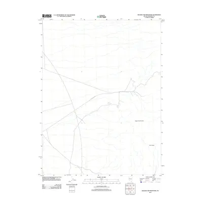
2011 Map of Ragged Top Mountain
USGS Topo · Published 2011About this map
Ragged Top Mountain dominates the landscape of this high-desert region in Pershing County, Nevada, where the arid slopes of the Trinity Range transition into the broad expanses of the Great Basin. This 2011 survey documents a sparsely populated but geographically significant area, primarily characterized by ephemeral drainages and the winding path of Ragged Top Rd. The absence of dense settlement highlights the remote nature of this part of the state, serving as a primary record of the topographic contours and the essential access routes used for mining or ranching activity in the early twenty-first century. For those studying the geography of Northern Nevada, the map provides a precise look at the landforms and limited human infrastructure in this section of the range.
Find a feature on this map
3 named features on this map. Tap any name to fly to it.
Don’t see what you’re looking for? This feature index may not catch every label — zoom into the map to look around manually.
Map Details
Editions of this 2011 Ragged Top Mountain Map
This is the sole edition of this map. No revisions or reprints were ever made.
Other maps of this area

1908 · Carson Sink
USGS Topo · 1:250,000

1910 · Carson Sink
USGS Topo · 1:250,000

1931 · Lovelock
USGS Topo · 1:250,000

1935 · Lovelock
USGS Topo · 1:250,000

1951 · Carson Sink
USGS Topo · 1:62,500

1951 · Desert Peak
USGS Topo · 1:62,500

1955 · Lovelock
USGS Topo · 1:250,000

1956 · Toulon
USGS Topo · 1:62,500

1957 · Reno
USGS Topo · 1:250,000

1959 · Lovelock
USGS Topo · 1:250,000