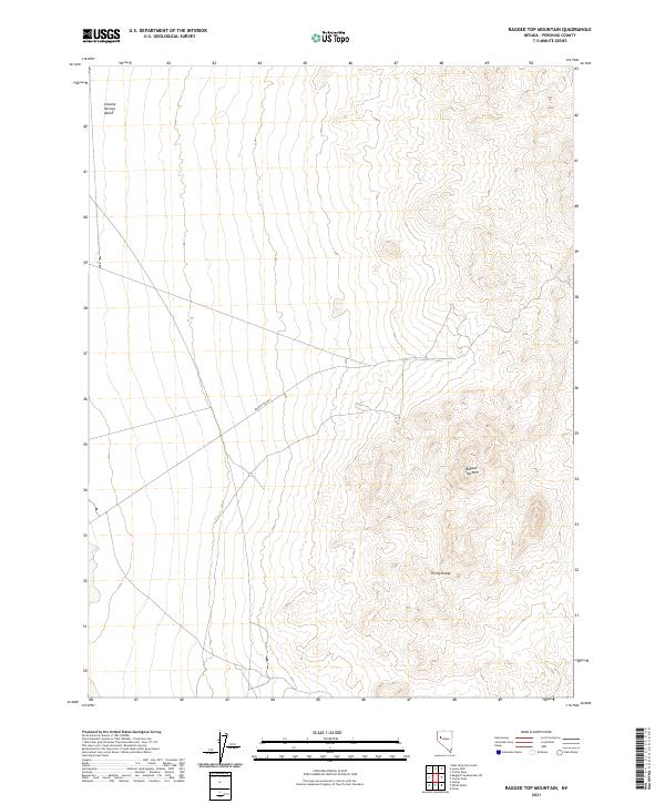
2021 Map of Ragged Top Mountain
USGS Topo · Published 2021About this map
Granite Springs Valley defines the western expanse of this high-desert landscape in Pershing County, where the topography shifts from flat alluvial basins to the complex ridgelines of the Trinity Range. At the center of the survey lies the prominent summit of Ragged Top Mtn, a landform that serves as a primary geographic anchor for the surrounding region. The human imprint on this desert terrain is sparse, centered primarily on the unimproved path of Ragged Top Rd which cuts through the sagebrush and rocky outcroppings. This 2021 map provides a modern record of the area's enduring isolation and the precise boundaries of the Public Land Survey System, including t26n r28e, t26n r29e, t25n r28e, and t25n r29e, documenting the township and range divisions that have defined Nevada's land management for over a century.
Find a feature on this map
8 named features on this map. Tap any name to fly to it.
Don’t see what you’re looking for? This feature index may not catch every label — zoom into the map to look around manually.
Map Details
Editions of this 2021 Ragged Top Mountain Map
This is the sole edition of this map. No revisions or reprints were ever made.
Other maps of this area

1908 · Carson Sink
USGS Topo · 1:250,000

1910 · Carson Sink
USGS Topo · 1:250,000

1931 · Lovelock
USGS Topo · 1:250,000

1935 · Lovelock
USGS Topo · 1:250,000

1951 · Carson Sink
USGS Topo · 1:62,500

1951 · Desert Peak
USGS Topo · 1:62,500

1955 · Lovelock
USGS Topo · 1:250,000

1956 · Toulon
USGS Topo · 1:62,500

1957 · Reno
USGS Topo · 1:250,000

1959 · Lovelock
USGS Topo · 1:250,000