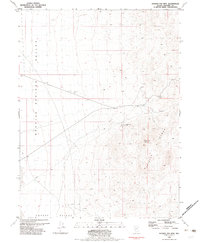
1981 Map of Ragged Top Mtn
USGS Topo · Published 1982About this map
Granite Springs Valley and Copper Valley converge in this remote Pershing County desert landscape, where the flat basin floor meets the rising peaks of the Trinity Range. The map documents a landscape defined by its mineral potential and infrastructure during the early 1980s. Industrial activity is centered on Ragged Top Mountain, which serves as the anchor for both the Ragged Top Mine and several smaller operations. A single Pipeline cuts a straight path across the valley floors, highlighting the utilitarian nature of the land use. Beyond the main mining sites, scattered features like a Prospect and Borrow Pit indicate the ongoing search for resources in this arid environment, providing a detailed record of Great Basin mining history before more modern developments altered these sites.
Find a feature on this map
9 named features on this map. Tap any name to fly to it.
Don’t see what you’re looking for? This feature index may not catch every label — zoom into the map to look around manually.
Map Details
Editions of this 1981 Ragged Top Mtn Map
This is the sole edition of this map. No revisions or reprints were ever made.
Other maps of this area

1908 · Carson Sink
USGS Topo · 1:250,000

1910 · Carson Sink
USGS Topo · 1:250,000

1931 · Lovelock
USGS Topo · 1:250,000

1935 · Lovelock
USGS Topo · 1:250,000

1951 · Carson Sink
USGS Topo · 1:62,500

1951 · Desert Peak
USGS Topo · 1:62,500

1955 · Lovelock
USGS Topo · 1:250,000

1956 · Toulon
USGS Topo · 1:62,500

1957 · Reno
USGS Topo · 1:250,000

1959 · Lovelock
USGS Topo · 1:250,000