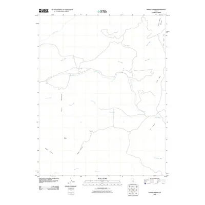
2010 Map of Raggy Canyon
USGS Topo · Published 2010About this map
The eastern foothills of the Henry Mountains dominate this high-desert landscape in Garfield County. Water is the primary architect of the geography here, defined by an intricate network of drainages including Crescent Creek, Butler Wash, and Copper Creek that carve through the arid terrain. Key water sources like Lecleed Spring provided essential relief in a region where named landmarks such as Little Egypt and Pyserts Hole speak to the unique geologic formations and historical human presence in the backcountry. The map details the transition from the high Poison Spring Benches down through steep-walled corridors like Raggy Canyon and Trail Canyon. These features illustrate the difficult travel routes and land-use patterns common in the remote canyon country of southern Utah, where every spring and passable wash was critical for survival and navigation.
Find a feature on this map
17 named features on this map. Tap any name to fly to it.
Don’t see what you’re looking for? This feature index may not catch every label — zoom into the map to look around manually.
Map Details
Editions of this 2010 Raggy Canyon Map
This is the sole edition of this map. No revisions or reprints were ever made.
Other maps of this area

1885 · San Rafael
USGS Topo · 1:250,000

1886 · Henry Mountains
USGS Topo · 1:250,000

1892 · Henry Mountains
USGS Topo · 1:250,000

1952 · Mount Ellen 4 SW
USGS Topo · 1:24,000

1952 · Mt Pennell 2 NE
USGS Topo · 1:24,000

1952 · Mt Pennell 1 NE
USGS Topo · 1:24,000

1952 · Mt Hillers
USGS Topo · 1:62,500

1952 · Mt. Ellen 4 NW
USGS Topo · 1:24,000

1952 · Mt Pennell 1 NW
USGS Topo · 1:24,000

1952 · Bull Mountain
USGS Topo · 1:62,500