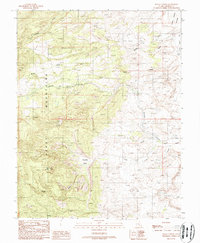
1988 Map of Raggy Canyon
USGS Topo · Published 1988About this map
The Henry Mountains dominate this 1980s landscape, where complex drainage patterns reveal a history of resource exploration across the Garfield and Utah county line. The terrain is marked by numerous prospects and adits, particularly concentrated near Crescent Creek and Copper Creek, indicating the region's enduring mining interest. Natural water sources like Leclerd Spring and the drainage of Raggy Canyon Creek define the habitable zones within this arid environment.
Find a feature on this map
25 named features on this map. Tap any name to fly to it.
Don’t see what you’re looking for? This feature index may not catch every label — zoom into the map to look around manually.
Map Details
Editions of this 1988 Raggy Canyon Map
This is the sole edition of this map. No revisions or reprints were ever made.
Other maps of this area

1885 · San Rafael
USGS Topo · 1:250,000

1886 · Henry Mountains
USGS Topo · 1:250,000

1892 · Henry Mountains
USGS Topo · 1:250,000

1952 · Mount Ellen 4 SW
USGS Topo · 1:24,000

1952 · Mt Pennell 2 NE
USGS Topo · 1:24,000

1952 · Mt Pennell 1 NE
USGS Topo · 1:24,000

1952 · Mt Hillers
USGS Topo · 1:62,500

1952 · Mt. Ellen 4 NW
USGS Topo · 1:24,000

1952 · Mt Pennell 1 NW
USGS Topo · 1:24,000

1952 · Bull Mountain
USGS Topo · 1:62,500