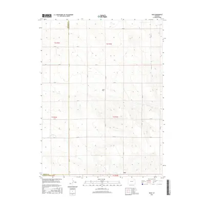
2016 Map of Rago
USGS Topo · Published 2016About this map
The settlement of Rago sits at the southern edge of this High Plains landscape, situated along the border of Morgan and Washington counties. This 2016 survey illustrates the organized grid of county roads that define the rural infrastructure, including Co RD 32 and Co RD 30, which facilitate movement between the sprawling agricultural sections. Natural drainage patterns are defined by the seasonal flow of Buck Cr and Camp Cr, while the land is further sculpted by the notable Shears Draw in the central portion of the quadrangle. The map captures the intersection of several townships, specifically t2n r54w and t1n r54w, providing a clear record of land ownership boundaries and transportation corridors in this corner of Colorado.
Find a feature on this map
31 named features on this map. Tap any name to fly to it.
Don’t see what you’re looking for? This feature index may not catch every label — zoom into the map to look around manually.
Map Details
Editions of this 2016 Rago Map
This is the sole edition of this map. No revisions or reprints were ever made.
Other maps of this area

1954 · Limon
USGS Topo · 1:250,000

1954 · Sterling
USGS Topo · 1:250,000

1957 · Limon
USGS Topo · 1:250,000

1958 · Limon
USGS Topo · 1:250,000

1958 · Sterling
USGS Topo · 1:250,000

1965 · Gary
USGS Topo · 1:24,000

1965 · Miller Ranch
USGS Topo · 1:24,000

1973 · Woodrow
USGS Topo · 1:24,000

1973 · Antelope Creek East
USGS Topo · 1:24,000

1973 · Antelope Creek West
USGS Topo · 1:24,000