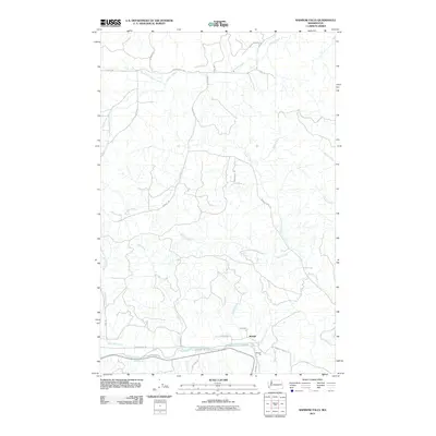
2011 Map of Rainbow Falls
USGS Topo · Published 2011About this map
Meskill sits as a central settlement node in this western Lewis County landscape, where the Chehalis River winds through the southern portion of the quadrangle. The terrain is defined by an intricate drainage system, with Lincoln Creek and its north and south forks carving through the northern territory, while Bunker Creek and Prairie Creek dominate the central elevations. Near the river, the namesake Rainbow Falls provides a significant geographic landmark, accompanied by local industrial history at the Meskill Pit. A network of rural roads such as Ceres-Dryad Rd and Hatchery Rd connects the scattered homes and properties, following the natural contours of the river valley and the creek beds. This 2011 survey captures the area's transition between agricultural river bottoms and the heavily forested uplands of the Pacific Northwest.
Find a feature on this map
38 named features on this map. Tap any name to fly to it.
Don’t see what you’re looking for? This feature index may not catch every label — zoom into the map to look around manually.
Map Details
Editions of this 2011 Rainbow Falls Map
This is the sole edition of this map. No revisions or reprints were ever made.
Other maps of this area

1941 · Walville
USGS Topo · 1:62,500

1941 · Meskill
USGS Topo · 1:62,500

1941 · Gate
USGS Topo · 1:62,500

1941 · Ford
USGS Topo · 1:62,500

1953 · Hoquiam
USGS Topo · 1:250,000

1953 · Rochester
USGS Topo · 1:62,500

1953 · Pe Ell
USGS Topo · 1:62,500

1953 · Malone
USGS Topo · 1:62,500

1953 · Adna
USGS Topo · 1:62,500

1957 · Hoquiam
USGS Topo · 1:250,000