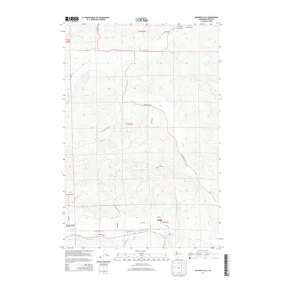
2014 Map of Rainbow Falls
USGS Topo · Published 2014About this map
The Chehalis River defines the southern reach of this landscape, where the small communities of Meskill and Dryad sit along the corridor of Wa-6. This area of Lewis County is characterized by the confluence of numerous drainage systems, most notably Rainbow Falls and the surrounding river bottomlands. Industrial and logistical history is evident in the Meskill Pit and a network of logging and forest roads like Bunker Creek Rd and Leudinghaus Rd that penetrate the rising timberland to the north. To the northeast, the Lincoln Creek Valley provides a distinct geographical corridor, fed by the N Fork Lincoln Cr and S Fork Lincoln Cr. The map's layout of gated forest access points and named creek drainages such as Bunker Cr and Marcuson Cr illustrates the intersection of rural residential life and the managed timber economy of the Pacific Northwest.
Find a feature on this map
46 named features on this map. Tap any name to fly to it.
Don’t see what you’re looking for? This feature index may not catch every label — zoom into the map to look around manually.
Map Details
Editions of this 2014 Rainbow Falls Map
This is the sole edition of this map. No revisions or reprints were ever made.
Other maps of this area

1941 · Walville
USGS Topo · 1:62,500

1941 · Meskill
USGS Topo · 1:62,500

1941 · Gate
USGS Topo · 1:62,500

1941 · Ford
USGS Topo · 1:62,500

1953 · Hoquiam
USGS Topo · 1:250,000

1953 · Rochester
USGS Topo · 1:62,500

1953 · Pe Ell
USGS Topo · 1:62,500

1953 · Malone
USGS Topo · 1:62,500

1953 · Adna
USGS Topo · 1:62,500

1957 · Hoquiam
USGS Topo · 1:250,000