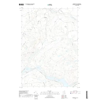
2019 Map of Rainbow Falls
USGS Topo · Published 2019About this map
The Raquette River dominates the southern landscape of this Saint Lawrence County survey, where a series of hydro-electric developments has transformed the waterway into the South Colton Reservoir, Five Falls Reservoir, and Rainbow Falls Reservoir. These engineered basins contrast with the natural wetland systems of Wheeler Marsh and the numerous glacial water bodies like Long Pond, Clear Pond, and Lilypad Pond that dot the eastern forest.
Find a feature on this map
55 named features on this map. Tap any name to fly to it.
Don’t see what you’re looking for? This feature index may not catch every label — zoom into the map to look around manually.
Map Details
Editions of this 2019 Rainbow Falls Map
This is the sole edition of this map. No revisions or reprints were ever made.
Other maps of this area

1908 · Potsdam
USGS Topo · 1:62,500

1919 · Nicholville
USGS Topo · 1:62,500

1920 · Childwold
USGS Topo · 1:62,500

1921 · Childwold
USGS Topo · 1:48,000

1921 · Nicholville
USGS Topo · 1:62,500

1921 · Stark
USGS Topo · 1:62,500

1922 · Childwold
USGS Topo · 1:62,500

1923 · Stark
USGS Topo · 1:62,500

1940 · Stark
USGS Topo · 1:62,500

1942 · Long Bow
USGS Topo · 1:24,000