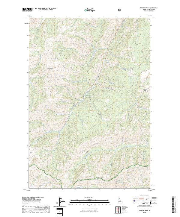
2024 Map of Rainbow Peak
USGS Topo · Published 2024About this map
Roosevelt Lake and the drainage of Monumental Creek anchor this topographic view of the Salmon River Mountains. The landscape is defined by the convergence of three major protected areas: the Frank Church-River of No Return Wilderness, Payette National Forest, and Boise National Forest. High-elevation landmarks such as Rainbow Peak, Dewey Hill, and Thunder Mtn rise above a complex network of waterways, including Annie Creek and Threemile Creek. The presence of the Monumental Creek Trl and the Nat For Dev Rd 375 suggests a primitive transportation corridor through these steep drainages. Topographical details illustrate the varied terrain from Gold Ridge down to the confluence of the South Fork Trap Creek, providing a clear record of the watershed and ridges that historically dictated access to this central Idaho backcountry.
Find a feature on this map
49 named features on this map. Tap any name to fly to it.
Don’t see what you’re looking for? This feature index may not catch every label — zoom into the map to look around manually.
Map Details
Editions of this 2024 Rainbow Peak Map
This is the sole edition of this map. No revisions or reprints were ever made.
Other maps of this area

1937 · Yellow Pine
USGS Topo · 1:48,000

1937 · Big Creek
USGS Topo · 1:48,000

1942 · Big Creek
USGS Topo · 1:62,500

1943 · Yellow Pine
USGS Topo · 1:62,500

1956 · Elk City
USGS Topo · 1:250,000

1957 · Challis
USGS Topo · 1:250,000

1960 · Elk City
USGS Topo · 1:250,000

1960 · Challis
USGS Topo · 1:250,000

1963 · Challis
USGS Topo · 1:250,000

1969 · Edwardsburg
USGS Topo · 1:24,000