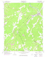
1969 Map of Rainelle
USGS Topo · Published 1977About this map
Meadow River defines the industrial and topographic heart of this West Virginia landscape, where the Chesapeake and Ohio railroad follows the water's edge to serve the town of Rainelle. This 1969 survey, with 1976 revisions, reveals a territory profoundly shaped by coal and timber extraction, evidenced by the extensive strip mine operations and smaller mines dotting Wolfpen Ridge and Sewell Mountain. Local life is anchored in small settlements like Aldrich Camp, Lilly Park, and Bellwood, each connected by a network of rural roads and rail spurs.
Find a feature on this map
56 named features on this map. Tap any name to fly to it.
Don’t see what you’re looking for? This feature index may not catch every label — zoom into the map to look around manually.
Map Details
Editions of this 1969 Rainelle Map
2 editions found
Other maps of this area

1887 · Hinton
USGS Topo · 1:125,000

1889 · Nicholas
USGS Topo · 1:125,000

1891 · Nicholas
USGS Topo · 1:125,000

1892 · Hinton
USGS Topo · 1:125,000

1901 · Nicholas
USGS Topo · 1:125,000

1912 · Meadow Creek
USGS Topo · 1:48,000

1914 · Winona
USGS Topo · 1:48,000

1915 · Meadow Creek
USGS Topo · 1:62,500

1916 · Winona
USGS Topo · 1:62,500

1918 · Richwood
USGS Topo · 1:62,500