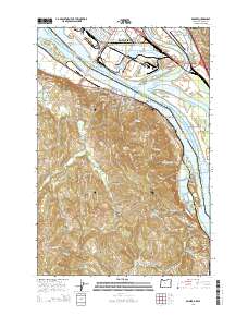
2014 Map of Rainier
USGS Topo · Published 2014About this map
The Columbia River serves as the central artery and state boundary in this 2014 survey, where the industrial activity of Longview and Kelso meets the timbered uplands of the Oregon side. The river's complexity is revealed through named reaches like Slaughters Channel and a series of navigational aids including the Cottonwood Island Lower Range. On the Washington shore, the Southwest Washington Regional Airport and the rail hub at Longview Junction anchor the regional economy, while the Oregon side near Rainier is marked by a more dispersed settlement pattern of small communities like Beaver Valley and Beaver Homes. Genealogists will find several burial grounds noted, including Hudson Cem and the Knights of Pythias Cem. The landscape transitions from the riverfront flats of Prescott Bar to the interior heights around Beaver Springs, where numerous creeks such as Goble Cr and Neer Cr carve through the terrain toward the main channel.
Find a feature on this map
145 named features on this map. Tap any name to fly to it.
Don’t see what you’re looking for? This feature index may not catch every label — zoom into the map to look around manually.
Map Details
Editions of this 2014 Rainier Map
This is the sole edition of this map. No revisions or reprints were ever made.
Other maps of this area

1919 · Mayger
USGS Topo · 1:62,500

1921 · Kalama
USGS Topo · 1:62,500

1922 · St. Helens
USGS Topo · 1:62,500

1940 · Vernonia
USGS Topo · 1:62,500

1941 · St Helens
USGS Topo · 1:62,500

1941 · Clatskanie
USGS Topo · 1:62,500

1943 · Vernonia
USGS Topo · 1:62,500

1943 · St Helens
USGS Topo · 1:62,500

1948 · Vancouver
USGS Topo · 1:250,000

1950 · Vancouver
USGS Topo · 1:250,000