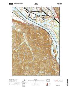
2020 Map of Rainier
USGS Topo · Published 2020About this map
The Columbia River serves as the central artery and state boundary in this 2020 record of the industrial and rural landscapes between Oregon and Washington. The northern bank is dominated by the industrial infrastructure of Longview and Kelso, including the Southwest Washington Regional Airport and the complex rail network at Longview Junction. Connecting these hubs to the Oregon shore is the Lewis and Clark Bridge, leading toward the riverfront community of Rainier.
Find a feature on this map
139 named features on this map. Tap any name to fly to it.
Don’t see what you’re looking for? This feature index may not catch every label — zoom into the map to look around manually.
Map Details
Editions of this 2020 Rainier Map
This is the sole edition of this map. No revisions or reprints were ever made.
Other maps of this area

1919 · Mayger
USGS Topo · 1:62,500

1921 · Kalama
USGS Topo · 1:62,500

1922 · St. Helens
USGS Topo · 1:62,500

1940 · Vernonia
USGS Topo · 1:62,500

1941 · St Helens
USGS Topo · 1:62,500

1941 · Clatskanie
USGS Topo · 1:62,500

1943 · Vernonia
USGS Topo · 1:62,500

1943 · St Helens
USGS Topo · 1:62,500

1948 · Vancouver
USGS Topo · 1:250,000

1950 · Vancouver
USGS Topo · 1:250,000