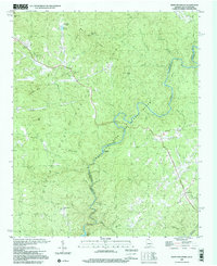
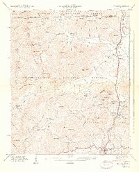
1997 Map of Rainy Mountain
USGS Topo · Published 2001About this map
The Chattooga River forms a winding natural border between Rabun County, Georgia and Oconee County, South Carolina in this late 20th-century survey. The landscape is defined by the sharp elevations of Rainy Mountain, Screamer Mountain, and Boggs Mountain, separated by a dense network of drainages like Stekoa Creek and Chechero Creek. While much of the land is preserved within the Chattahoochee and Sumter National Forests, the presence of numerous rural congregations such as New Hope Ch, Wolf Creek Ch, and Laurel Spring Ch indicates the enduring footprint of small communities across these ridges. Notable water features include Lake Toccoa in the northwest and Tugaloo Lake to the south, while the Chattooga Wild and Scenic River corridor highlights the region's focus on conservation and recreation, marked by landmarks like Woodall Shoals.
Find a feature on this map
51 named features on this map. Tap any name to fly to it.
Don’t see what you’re looking for? This feature index may not catch every label — zoom into the map to look around manually.
Map Details
Editions of this 1997 Rainy Mountain Map
This is the sole edition of this map. No revisions or reprints were ever made.
Other maps of this area

1886 · Walhalla
USGS Topo · 1:125,000

1892 · Walhalla
USGS Topo · 1:125,000

1896 · Walhalla
USGS Topo · 1:125,000

1935 · Dillard
USGS Topo · 1:24,000

1935 · Rabun Bald
USGS Topo · 1:24,000
1946 · Dillard
USGS Topo · 1:24,000
1946 · Rabun Bald
USGS Topo · 1:24,000
1947 · Rabun Bald
USGS Topo · 1:24,000
1947 · Dillard
USGS Topo · 1:24,000

1953 · Tallulah Falls
USGS Topo · 1:24,000