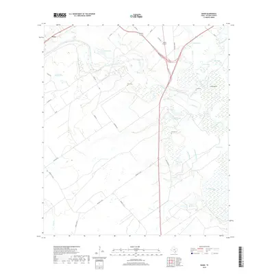
2019 Map of Raisin
USGS Topo · Published 2019About this map
Raisin sits at the northwest edge of this 2019 survey, an area of Victoria County defined by the complex hydrology of the Guadalupe River and its numerous bayous and oxbow lakes. The landscape is characterized by a high density of water features, including Coleto Creek, Black Bayou, and Sand Bayou, which create a winding network of wetlands across the coastal plain. Notable landmarks for local history include an Indian Mound near the river bend and several small family burial grounds such as McDonald Cem, Joshua Cem, and Reeves Cem. The settlement pattern is largely rural, with established routes like Old Refugio Rd and Kemper City Rd E connecting disparate ranches and properties. Significant water bodies such as Terrell Lake and Adler Lake reflect the low-lying, water-rich environment that has historically influenced the development and land use of this region.
Find a feature on this map
43 named features on this map. Tap any name to fly to it.
Don’t see what you’re looking for? This feature index may not catch every label — zoom into the map to look around manually.
Map Details
Editions of this 2019 Raisin Map
This is the sole edition of this map. No revisions or reprints were ever made.
Other maps of this area

1951 · Bloomington
USGS Topo · 1:24,000

1952 · Bloomington SW
USGS Topo · 1:24,000

1952 · Victoria East
USGS Topo · 1:24,000

1953 · Beeville
USGS Topo · 1:250,000

1956 · Beeville
USGS Topo · 1:250,000

1960 · Beeville
USGS Topo · 1:250,000

1962 · Fannin
USGS Topo · 1:24,000

1962 · Lott Lake
USGS Topo · 1:24,000

1962 · McFaddin
USGS Topo · 1:24,000

1962 · Raisin
USGS Topo · 1:24,000