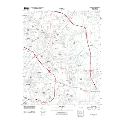
2010 Map of Raleigh East
USGS Topo · Published 2010About this map
Raleigh's eastern expansion is clearly visible in this 2010 survey, where established residential enclaves like Millbrook and Brentwood meet the evolving infrastructure of eastern Wake County. The landscape is defined by the winding course of the Neuse River and a dense network of water features including Milburnie Fish Club Lake, Beacon Lake, and Lake Anne. These water bodies, often formed by dams such as the Emily Babcock Dam, reflect the suburban development and local drainage patterns of the era.
Find a feature on this map
128 named features on this map. Tap any name to fly to it.
Don’t see what you’re looking for? This feature index may not catch every label — zoom into the map to look around manually.
Map Details
Editions of this 2010 Raleigh East Map
This is the sole edition of this map. No revisions or reprints were ever made.
Other maps of this area

1943 · Raleigh
USGS Topo · 1:62,500

1951 · Raleigh
USGS Topo · 1:62,500

1953 · Raleigh
USGS Topo · 1:250,000

1954 · Raleigh
USGS Topo · 1:250,000

1964 · Lake Wheeler
USGS Topo · 1:24,000

1964 · Garner
USGS Topo · 1:24,000

1964 · Selma
USGS Topo · 1:62,500

1964 · Clayton
USGS Topo · 1:24,000

1964 · Garner
USGS Topo · 1:62,500

1967 · Knightdale
USGS Topo · 1:24,000