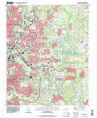
1993 Map of Raleigh East
USGS Topo · Published 1998About this map
Raleigh's eastern expansion is clearly visible in the early 1990s as suburban residential development pushes toward the Neuse River. The landscape is a transition between the established city center, featuring St Augustines College and Longview Gardens Park, and the outlying communities of Millbrook and New Hope. Significant infrastructure, including the Norfolk Southern rail line and numerous highway interchanges like Interchange 14, facilitates this growth. Along the river valley, several water bodies such as Milburnie Lake and Neuseocoo Lake suggest the recreational and environmental boundaries of the city’s sprawl. Local education and faith are represented by long-standing institutions like Enloe High School and Wake Chapel, while the State Correctional Center stands as a notable civic landmark on the southwestern edge of the survey.
Find a feature on this map
71 named features on this map. Tap any name to fly to it.
Don’t see what you’re looking for? This feature index may not catch every label — zoom into the map to look around manually.
Map Details
Editions of this 1993 Raleigh East Map
This is the sole edition of this map. No revisions or reprints were ever made.
Other maps of this area

1943 · Raleigh
USGS Topo · 1:62,500

1951 · Raleigh
USGS Topo · 1:62,500

1953 · Raleigh
USGS Topo · 1:250,000

1954 · Raleigh
USGS Topo · 1:250,000

1964 · Lake Wheeler
USGS Topo · 1:24,000

1964 · Garner
USGS Topo · 1:24,000

1964 · Selma
USGS Topo · 1:62,500

1964 · Clayton
USGS Topo · 1:24,000

1964 · Garner
USGS Topo · 1:62,500

1967 · Knightdale
USGS Topo · 1:24,000