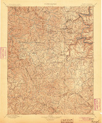
1902 Map of Raleigh
USGS Topo · Published 1905About this map
New River gorge and the surrounding plateau of southern West Virginia define this turn-of-the-century survey. The landscape is dominated by the narrow, winding river canyon where the Chesapeake and Ohio R. R. follows the water's edge, serving a string of riverside coal and transport settlements including Sewell, Thurmond, and McKendree. These towns, often squeezed between the water and the high cliffs of Sewell Mountain or Garden Ground Mt., contrast with the more dispersed agricultural communities on the heights like Beckley and Shady Spring.
Find a feature on this map
106 named features on this map. Tap any name to fly to it.
Don’t see what you’re looking for? This feature index may not catch every label — zoom into the map to look around manually.
Map Details
Editions of this 1902 Raleigh Map
3 editions found

Other maps of this area

1887 · Pocahontas
USGS Topo · 1:125,000

1887 · Hinton
USGS Topo · 1:125,000

1889 · Nicholas
USGS Topo · 1:125,000

1890 · Dublin
USGS Topo · 1:125,000

1891 · Tazewell
USGS Topo · 1:125,000

1891 · Nicholas
USGS Topo · 1:125,000

1891 · Pocahontas
USGS Topo · 1:125,000

1891 · Dublin
USGS Topo · 1:125,000

1891 · Oceana
USGS Topo · 1:125,000

1891 · Raleigh
USGS Topo · 1:125,000