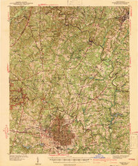
1943 Map of Raleigh
USGS Topo · Published 1943About this map
Raleigh and its northern rural environs are documented here just before the mid-century expansion, showing the state capital's grid surrounded by institutional landmarks and small agricultural crossroads. The presence of the State Penitentiary, State Hospital, and State Fairgrounds on the city's periphery illustrates its role as North Carolina's administrative hub. Beyond the city limits, the landscape transitions into a network of creek-side communities and rural schools such as the Rosenwald Sch and the Lovely Hill Sch, reflecting the segregated educational infrastructure of the period.
Find a feature on this map
85 named features on this map. Tap any name to fly to it.
Don’t see what you’re looking for? This feature index may not catch every label — zoom into the map to look around manually.
Map Details
Editions of this 1943 Raleigh Map
2 editions found
Other maps of this area

1943 · Durham South
USGS Topo · 1:62,500

1943 · Raleigh
USGS Topo · 1:62,500

1943 · Creedmoor
USGS Topo · 1:62,500

1944 · Creedmoor
USGS Topo · 1:62,500

1951 · Raleigh
USGS Topo · 1:62,500

1951 · Durham South
USGS Topo · 1:62,500

1951 · Durham North
USGS Topo · 1:62,500

1953 · Raleigh
USGS Topo · 1:250,000

1953 · Greensboro
USGS Topo · 1:250,000

1954 · Greensboro
USGS Topo · 1:250,000