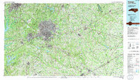
1990 Map of Raleigh
USGS Topo · Published 1991About this map
Raleigh stands as the central hub of this North Carolina landscape, where a dense network of roads and rail lines, including the Southern and Seaboard System, converge to connect the capital with its surrounding neighbors. The transition from the urban centers of Durham and Cary to the agrarian communities of Garner and Clayton is well documented. Local history is preserved in the names of smaller settlements like Emerald Village, Chalybeate Springs, and Shotwell, many of which remain distinct before the accelerating suburban expansion of the late 20th century.
Find a feature on this map
81 named features on this map. Tap any name to fly to it.
Don’t see what you’re looking for? This feature index may not catch every label — zoom into the map to look around manually.
Map Details
Editions of this 1990 Raleigh Map
2 editions found
Other maps of this area

1902 · Kenly
USGS Topo · 1:62,500

1902 · Rocky Mount
USGS Topo · 1:62,500

1902 · Spring Hope
USGS Topo · 1:62,500

1903 · Kenly
USGS Topo · 1:62,500

1904 · Rocky Mount
USGS Topo · 1:62,500

1904 · Springhope
USGS Topo · 1:62,500

1904 · Wilson
USGS Topo · 1:62,500

1906 · Four Oaks
USGS Topo · 1:48,000

1908 · Four Oaks
USGS Topo · 1:62,500

1943 · Durham South
USGS Topo · 1:62,500