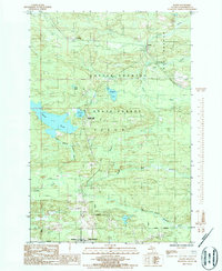
1986 Map of Ralph
USGS Topo · Published 1986About this map
Ralph and the smaller outpost of Stafford serve as the primary human touchpoints in this heavily wooded landscape within the Copper Country State Forest during the mid-1980s. The region is defined by its complex hydrology, where the Ford River and its West Branch meet, and the East Branch Sturgeon River flows through the southern terrain near Felch Mountain. This area of the Upper Peninsula exhibits a clear pattern of recreational and resource-based land use, indicated by the Campground at Genes Pond, a Boat Ramp on Pickerel Lake, and scattered extractive sites including a Quarry and Gravel Pit. Local life is further marked by a Cem and Po at Ralph, while a remote Landing Strip and a Footbridge over the river emphasize the navigation challenges of this forested wilderness.
Find a feature on this map
32 named features on this map. Tap any name to fly to it.
Don’t see what you’re looking for? This feature index may not catch every label — zoom into the map to look around manually.
Map Details
Editions of this 1986 Ralph Map
This is the sole edition of this map. No revisions or reprints were ever made.
Other maps of this area

1954 · Escanaba
USGS Topo · 1:250,000

1955 · Ralph NW
USGS Topo · 1:24,000

1955 · Ralph NE
USGS Topo · 1:24,000

1955 · Norway
USGS Topo · 1:62,500

1955 · Ralph
USGS Topo · 1:62,500

1956 · Foster City
USGS Topo · 1:62,500

1957 · Escanaba
USGS Topo · 1:250,000

1957 · Northland
USGS Topo · 1:62,500

1958 · Escanaba
USGS Topo · 1:250,000

1958 · Marquette
USGS Topo · 1:250,000