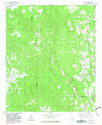
1970 Map of Ralph
USGS Topo · Published 1983About this map
The Greene Co Tuscaloosa Co border divides this rural landscape, which is defined by a dense network of creek drainages and small community hubs. Small settlements like Ralph and Snoddy anchor the area, supported by a significant concentration of country churches that suggest a long-established social fabric. Congregations at New Zion Ch, Mt Herman Ch, and Wesley Chapel are scattered among the timbered ridges, often accompanied by family or community burial grounds such as Old Shiloh Cem and Old Bethel Cem.
Find a feature on this map
28 named features on this map. Tap any name to fly to it.
Don’t see what you’re looking for? This feature index may not catch every label — zoom into the map to look around manually.
Map Details
Editions of this 1970 Ralph Map
2 editions found
Other maps of this area

1924 · Tuscaloosa
USGS Topo · 1:62,500

1926 · Tuscaloosa
USGS Topo · 1:62,500

1927 · Eutaw
USGS Topo · 1:48,000

1931 · Eutaw
USGS Topo · 1:62,500

1953 · Montgomery
USGS Topo · 1:250,000

1953 · Birmingham
USGS Topo · 1:250,000

1956 · Birmingham
USGS Topo · 1:250,000

1956 · Montgomery
USGS Topo · 1:250,000

1957 · Birmingham
USGS Topo · 1:250,000

1957 · Montgomery
USGS Topo · 1:250,000