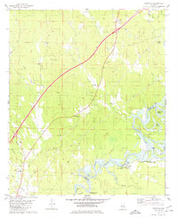
1980 Map of Knoxville
USGS Topo · Published 1980About this map
The Black Warrior River and the expansive Warrior Lake dominate the southern landscape of this 1980 survey, where the river serves as the boundary between Greene and Hale counties. This rural corridor is defined by its numerous small congregational centers and family-named water features. Notable spiritual and community landmarks such as New Bethany Ch, St Marys Ch, and Cedar Grove Ch are scattered across the terrain, often accompanied by local burial grounds like New Bethany Cem. The map illustrates the hydrological complexity of the area through features like Bohannons Cutoff, Stovers Lake, and Martin Slough. On the northern edge, the settlement of Knoxville sits at a highway junction, while further south, Oak Village provides access to the river's recreational facilities, including the Lock 8 Public Use Area and a Campground.
Find a feature on this map
43 named features on this map. Tap any name to fly to it.
Don’t see what you’re looking for? This feature index may not catch every label — zoom into the map to look around manually.
Map Details
Editions of this 1980 Knoxville Map
This is the sole edition of this map. No revisions or reprints were ever made.
Other maps of this area

1924 · Tuscaloosa
USGS Topo · 1:62,500

1926 · Tuscaloosa
USGS Topo · 1:62,500

1927 · Eutaw
USGS Topo · 1:48,000

1931 · Eutaw
USGS Topo · 1:62,500

1953 · Montgomery
USGS Topo · 1:250,000

1953 · Birmingham
USGS Topo · 1:250,000

1956 · Birmingham
USGS Topo · 1:250,000

1956 · Montgomery
USGS Topo · 1:250,000

1957 · Birmingham
USGS Topo · 1:250,000

1957 · Montgomery
USGS Topo · 1:250,000