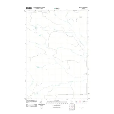
2011 Map of Ralph NE
USGS Topo · Published 2011About this map
The West Branch Escanaba River and North Branch Ford River anchor this landscape in Dickinson County, where a network of forest roads and remote waterways defines the terrain. The presence of the Escanaba River Lookout Tower in the northeast corner highlights the area's history of fire management and timber monitoring. A series of small lakes, including O'Neil Lake, Van Derlin Lake, and Mud Lake, are scattered between the drainages of Schwartz Creek and McGregor Creek. This topographical study illustrates a region primarily accessed via local routes such as Schwartz Creek Rd, Aimone Rd, and Steeles Rd, which cut through the dense Michigan backcountry to connect these isolated water bodies and river systems.
Find a feature on this map
20 named features on this map. Tap any name to fly to it.
Don’t see what you’re looking for? This feature index may not catch every label — zoom into the map to look around manually.
Map Details
Editions of this 2011 Ralph NE Map
This is the sole edition of this map. No revisions or reprints were ever made.
Other maps of this area

1952 · Ishpeming
USGS Topo · 1:62,500

1955 · Ralph NW
USGS Topo · 1:24,000

1955 · Ralph NE
USGS Topo · 1:24,000

1955 · Republic
USGS Topo · 1:62,500

1955 · Republic SW
USGS Topo · 1:24,000

1955 · Ralph
USGS Topo · 1:62,500

1957 · Northland
USGS Topo · 1:62,500

1958 · Marquette
USGS Topo · 1:250,000

1960 · Marquette
USGS Topo · 1:250,000

1961 · Marquette
USGS Topo · 1:250,000