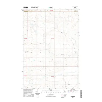
2014 Map of Ralph NE
USGS Topo · Published 2014About this map
The N Br Ford River and W Br Escanaba River systems converge in this remote timberland landscape on the border of Marquette and Dickinson Counties. This 2014 survey documents a rugged terrain defined by significant water bodies such as O'Neil Lake, Van Derlin Lake, and the marshy margins of Mud Lake. A network of logging and service roads, including Aimone Rd, Steeles Rd, and Forest Rd, provides the primary access through these wooded townships. The drainage patterns of Schwartz Creek and McGregor Cr illustrate the complex hydrology of the Upper Peninsula, where numerous small tributaries like Flat Rock Cr feed into the larger river branches. The map captures the area's character as a managed forest environment where specialized infrastructure like W Tower Rd and Co Road 581 serves the region's natural resource and recreational needs.
Find a feature on this map
28 named features on this map. Tap any name to fly to it.
Don’t see what you’re looking for? This feature index may not catch every label — zoom into the map to look around manually.
Map Details
Editions of this 2014 Ralph NE Map
This is the sole edition of this map. No revisions or reprints were ever made.
Other maps of this area

1952 · Ishpeming
USGS Topo · 1:62,500

1955 · Ralph NW
USGS Topo · 1:24,000

1955 · Ralph NE
USGS Topo · 1:24,000

1955 · Republic
USGS Topo · 1:62,500

1955 · Republic SW
USGS Topo · 1:24,000

1955 · Ralph
USGS Topo · 1:62,500

1957 · Northland
USGS Topo · 1:62,500

1958 · Marquette
USGS Topo · 1:250,000

1960 · Marquette
USGS Topo · 1:250,000

1961 · Marquette
USGS Topo · 1:250,000