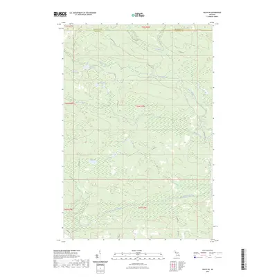
2023 Map of Ralph NE
USGS Topo · Published 2023About this map
The North Branch Ford River and West Branch Escanaba River define the hydraulic character of this Upper Peninsula landscape, where water drainage patterns dictate the historical access routes across the Marquette and Dickinson county line. The terrain is marked by a network of seasonal trails and backcountry roads such as Lake Oneil Rd and Schwartz Creek Rd, which provide access to isolated water bodies like O'Neil Lake, Van Derlin Lake, and Mud Lake. This area reflects the typical timber and recreation-focused land use of the central Upper Peninsula, where named features are primarily hydrologic or related to forest management infrastructure like W Tower Rd. The intricate wetlands surrounding McGregor Creek and Flat Rock Creek highlight the drainage challenges that have historically influenced road placement, including Co Hwy COO and Aimone Rd.
Find a feature on this map
29 named features on this map. Tap any name to fly to it.
Don’t see what you’re looking for? This feature index may not catch every label — zoom into the map to look around manually.
Map Details
Editions of this 2023 Ralph NE Map
This is the sole edition of this map. No revisions or reprints were ever made.
Other maps of this area

1952 · Ishpeming
USGS Topo · 1:62,500

1955 · Ralph NW
USGS Topo · 1:24,000

1955 · Ralph NE
USGS Topo · 1:24,000

1955 · Republic
USGS Topo · 1:62,500

1955 · Republic SW
USGS Topo · 1:24,000

1955 · Ralph
USGS Topo · 1:62,500

1957 · Northland
USGS Topo · 1:62,500

1958 · Marquette
USGS Topo · 1:250,000

1960 · Marquette
USGS Topo · 1:250,000

1961 · Marquette
USGS Topo · 1:250,000