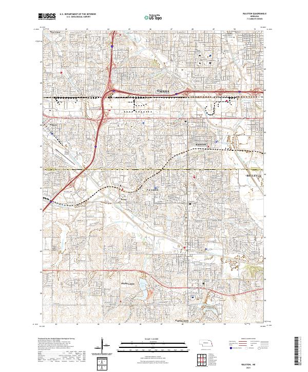
2021 Map of Ralston
USGS Topo · Published 2021About this map
The suburban development and drainage networks of Douglas and Sarpy Counties characterize this contemporary survey. Spanning the interface between southern Omaha and Papillion, the landscape is defined by the corridors of Big Papillion Cr and its many tributaries, including Rockbrook Cr and Westmont Cr. The map captures a high density of civic and educational institutions, from the University of Nebraska Omaha - Pacific Campus and College of Saint Mary in the north to the Metropolitan Community College - Sarpy Center further south. Local history is preserved in several significant burial grounds, such as Evergreen Memorial Park Cem and the historic Portal Cem. Modern water management and recreation are represented by the large reservoir at Walnut Creek Lake and the residential surroundings of Shadow Lake, illustrating the rapid growth of La Vista and Ralston.
Find a feature on this map
53 named features on this map. Tap any name to fly to it.
Don’t see what you’re looking for? This feature index may not catch every label — zoom into the map to look around manually.
Map Details
Editions of this 2021 Ralston Map
This is the sole edition of this map. No revisions or reprints were ever made.