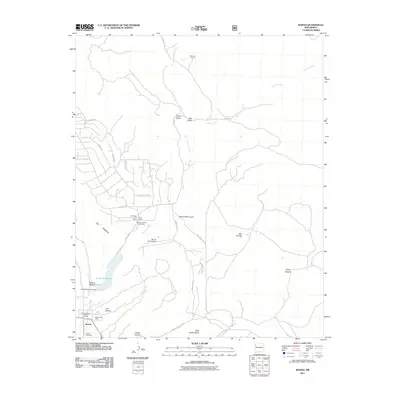
2011 Map of Ramah
USGS Topo · Published 2011About this map
The Ashcroft-Merrill Historic District anchors this high-desert landscape, preserving the early twentieth-century heritage of the Ramah community. This settlement is defined by its Mormon pioneering history, evidenced by the Mormon Colony Cemetery and the local Ramah Cemetery. The physical geography is dominated by a sharp rise known as The Hogback, which separates the high plateau from the lowlands of Cebolla Creek and the man-made Ramah Reservoir. Land use patterns here reflect a mix of traditional ranching and modern transitions, with family operations like the Old Bond Ranch, Clo-Chew-Tah Ranch, and Dent Ranch scattered across the valley. Transportation is a network of forest and tribal routes, including Indian Service Route 137 and Forest Rd 157, supporting both the town and the Ramah Lake Airstrip.
Find a feature on this map
41 named features on this map. Tap any name to fly to it.
Don’t see what you’re looking for? This feature index may not catch every label — zoom into the map to look around manually.
Map Details
Editions of this 2011 Ramah Map
This is the sole edition of this map. No revisions or reprints were ever made.
Other maps of this area

1886 · Wingate
USGS Topo · 1:250,000

1892 · Wingate
USGS Topo · 1:250,000

1954 · Gallup
USGS Topo · 1:250,000

1958 · Gallup
USGS Topo · 1:250,000

1959 · Gallup
USGS Topo · 1:250,000

1961 · Cottonwood Canyon
USGS Topo · 1:24,000

1962 · Gallup
USGS Topo · 1:250,000

1962 · Cottonwood Canyon
USGS Topo · 1:24,000

1962 · Page
USGS Topo · 1:24,000
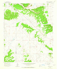
1963 · Togeye Lake
USGS Topo · 1:24,000
Featured Places
- Eastern Navajo Agency, NM
- Ramah, Eastern Navajo Agency
- McKinley County, NM
- Cibola County, NM
- United States