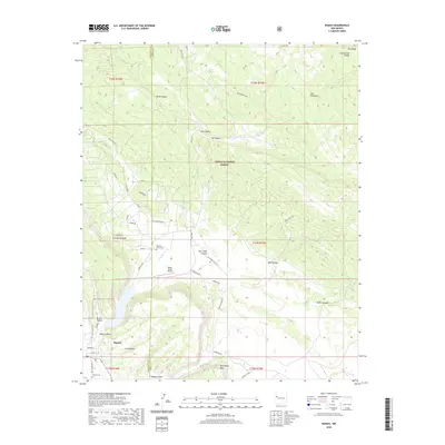
2020 Map of Ramah
USGS Topo · Published 2020About this map
Ramah and the surrounding Ramah Valley sit at a geographic crossroads where the Continental Divide meets the southern edge of the Zuñi Mountains. This modern survey illustrates the proximity of the Mormon Colony Cem to the local Ramah Reservoir, a vital water source in this arid landscape. The area is deeply carved by numerous drainages, including Burnt Mill Canyon and Togeye Canyon, which flow through the protected boundaries of the Cibola National Forest. To the south, high-relief features like Wild Sheep Mesa and Oso Ridge dominate the horizon. The presence of Mystic Bluffs Airport and a network of residential roads like Timberlake Rd and Sunrise Way reflects the contemporary settlement pattern of this rural New Mexico community while preserving access to its significant geological and ancestral landmarks.
Find a feature on this map
56 named features on this map. Tap any name to fly to it.
Don’t see what you’re looking for? This feature index may not catch every label — zoom into the map to look around manually.
Map Details
Editions of this 2020 Ramah Map
This is the sole edition of this map. No revisions or reprints were ever made.
Other maps of this area

1886 · Wingate
USGS Topo · 1:250,000

1892 · Wingate
USGS Topo · 1:250,000

1954 · Gallup
USGS Topo · 1:250,000

1958 · Gallup
USGS Topo · 1:250,000

1959 · Gallup
USGS Topo · 1:250,000

1961 · Cottonwood Canyon
USGS Topo · 1:24,000

1962 · Gallup
USGS Topo · 1:250,000

1962 · Cottonwood Canyon
USGS Topo · 1:24,000

1962 · Page
USGS Topo · 1:24,000
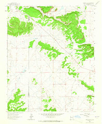
1963 · Togeye Lake
USGS Topo · 1:24,000
Featured Places
- Eastern Navajo Agency, NM
- Ramah, Eastern Navajo Agency
- McKinley County, NM
- Cibola County, NM
- United States