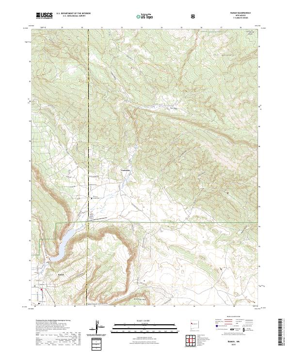
2023 Map of Ramah
USGS Topo · Published 2023About this map
Ramah and the neighboring residential community of Timberlake anchor this modern-era study of the New Mexico high country. Situated along the boundary of McKinley and Cibola counties, the landscape is defined by the Zuñi Mountains and the Continental Divide, where high-altitude drainages like Cebolla Creek and Dan Valley Spring carve through the sandstone terrain. The map captures the spiritual and aviation history of the valley, featuring the Mormon Colony Cem and Ramah Cem, alongside the Mystic Bluffs Airport.
Find a feature on this map
55 named features on this map. Tap any name to fly to it.
Don’t see what you’re looking for? This feature index may not catch every label — zoom into the map to look around manually.
Map Details
Editions of this 2023 Ramah Map
This is the sole edition of this map. No revisions or reprints were ever made.
Other maps of this area

1886 · Wingate
USGS Topo · 1:250,000

1892 · Wingate
USGS Topo · 1:250,000

1954 · Gallup
USGS Topo · 1:250,000

1958 · Gallup
USGS Topo · 1:250,000

1959 · Gallup
USGS Topo · 1:250,000

1961 · Cottonwood Canyon
USGS Topo · 1:24,000

1962 · Gallup
USGS Topo · 1:250,000

1962 · Cottonwood Canyon
USGS Topo · 1:24,000

1962 · Page
USGS Topo · 1:24,000
1963 · Togeye Lake
USGS Topo · 1:24,000
Featured Places
- Eastern Navajo Agency, NM
- Ramah, Eastern Navajo Agency
- McKinley County, NM
- Cibola County, NM
- United States