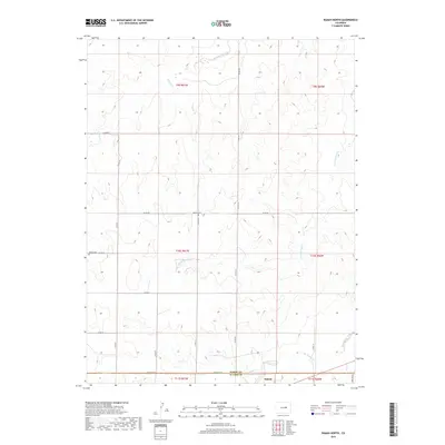
2019 Map of Ramah North
USGS Topo · Published 2019About this map
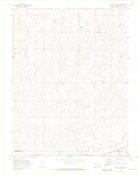
Big Sandy Creek flows across the southern plains of this landscape, where the settlement of Ramah is situated near the Elbert Co El Paso Co line. This region is defined by a series of north-flowing drainages, including East Bijou Creek and its tributary E Bijou Cr, alongside the winding course of Reed Springs Cr. The grid of rural roads, such as Co RD 105 and Co RD 90, connects isolated points of local heritage. Genealogists will find the locations of Sproch Cem and Sakala Cem particularly noteworthy, as these small cemeteries serve as primary markers of the area's early ranching or farming families. The topography reveals a rolling prairie environment where seasonal watercourses like Antelope Cr have carved distinct draws into the high plains terrain.
Find a feature on this map
27 named features on this map. Tap any name to fly to it.
Don’t see what you’re looking for? This feature index may not catch every label — zoom into the map to look around manually.
Map Details
Editions of this 2019 Ramah North Map
This is the sole edition of this map. No revisions or reprints were ever made.
Other maps of this area

1953 · Denver
USGS Topo · 1:250,000

1957 · Denver
USGS Topo · 1:250,000

1958 · Denver
USGS Topo · 1:250,000

1960 · Denver
USGS Topo · 1:250,000

1970 · Big Gulch
USGS Topo · 1:24,000
1970 · Fondis
USGS Topo · 1:24,000
1970 · Bijou SW
USGS Topo · 1:24,000
1970 · Ramah South
USGS Topo · 1:24,000
1970 · Ramah North
USGS Topo · 1:24,000
1970 · Alta Vista
USGS Topo · 1:24,000