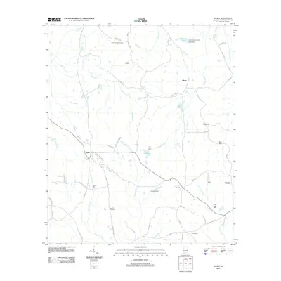
2011 Map of Ramer
USGS Topo · Published 2011About this map
The town of Ramer serves as a central hub for this portion of southern Montgomery County, anchored by the Ramer Post Office and a network of rural routes. The landscape is defined by the winding paths of Ramer Creek and Patsaliga Creek, which are punctuated by numerous small dams and private water bodies such as C E Sellers Lake and Evans Lake. Small settlements like Dublin, Gibson, and Friendship are scattered across the terrain, connected by historical corridors like Story Rd and Smiley Ferry Rd.
Find a feature on this map
58 named features on this map. Tap any name to fly to it.
Don’t see what you’re looking for? This feature index may not catch every label — zoom into the map to look around manually.
Map Details
Editions of this 2011 Ramer Map
This is the sole edition of this map. No revisions or reprints were ever made.
Other maps of this area

1953 · Montgomery
USGS Topo · 1:250,000

1953 · Andalusia
USGS Topo · 1:250,000

1956 · Montgomery
USGS Topo · 1:250,000

1957 · Montgomery
USGS Topo · 1:250,000

1957 · Andalusia
USGS Topo · 1:250,000

1957 · Letohatchee
USGS Topo · 1:62,500
1968 · Ansley
USGS Topo · 1:24,000

1968 · Grady
USGS Topo · 1:24,000

1971 · Davis Crossroads
USGS Topo · 1:24,000
1971 · Teasleys Mill
USGS Topo · 1:24,000