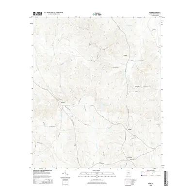
2014 Map of Ramer
USGS Topo · Published 2014About this map
Ramer and Dublin anchor this Montgomery County landscape, where a dense network of country roads like Hillabee Rd and Ramer Grady Rd connects small rural settlements. The area is defined by its water system, with the headwaters and tributaries of Patsaliga Creek and Weaver Mill Creek winding through the terrain. Several small lakes, such as Bob Thompson Lake and Rushing Lake, are scattered across the quadrangle, indicating a region characterized by small-scale agriculture and private landholdings. Genealogists and local historians can locate several family and community burial grounds, including Chesser Cem, Sentell Cem, and Hills Chapel Cem. The settlement pattern follows old transit routes like the Al-94 corridor, which ties together the communities of Meadville and Friendship with the surrounding creek valleys.
Find a feature on this map
55 named features on this map. Tap any name to fly to it.
Don’t see what you’re looking for? This feature index may not catch every label — zoom into the map to look around manually.
Map Details
Editions of this 2014 Ramer Map
This is the sole edition of this map. No revisions or reprints were ever made.
Other maps of this area

1953 · Montgomery
USGS Topo · 1:250,000

1953 · Andalusia
USGS Topo · 1:250,000

1956 · Montgomery
USGS Topo · 1:250,000

1957 · Montgomery
USGS Topo · 1:250,000

1957 · Andalusia
USGS Topo · 1:250,000

1957 · Letohatchee
USGS Topo · 1:62,500
1968 · Ansley
USGS Topo · 1:24,000

1968 · Grady
USGS Topo · 1:24,000

1971 · Davis Crossroads
USGS Topo · 1:24,000
1971 · Teasleys Mill
USGS Topo · 1:24,000