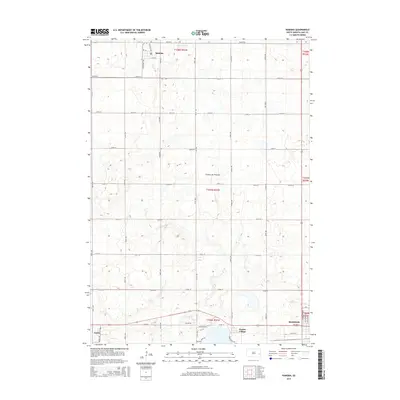
2015 Map of Ramona
USGS Topo · Published 2015About this map
Coteau des Prairies, a vast glacial highland, defines the undulating topography of this Lake County landscape. The town of Ramona sits in the northern reaches, while the northern edge of Madison appears at the southern border, marking the region's primary population centers. A distinctive cultural landmark, Prairie Village, is situated just west of Madison, preserving a collection of historical structures and steam-era machinery on the prairie.
Find a feature on this map
27 named features on this map. Tap any name to fly to it.
Don’t see what you’re looking for? This feature index may not catch every label — zoom into the map to look around manually.
Map Details
Editions of this 2015 Ramona Map
This is the sole edition of this map. No revisions or reprints were ever made.
Other maps of this area

1953 · Watertown
USGS Topo · 1:250,000

1955 · Sioux Falls
USGS Topo · 1:250,000

1958 · Sioux Falls
USGS Topo · 1:250,000

1958 · Watertown
USGS Topo · 1:250,000

1968 · Lake Madison
USGS Topo · 1:24,000

1968 · Ramona
USGS Topo · 1:24,000

1968 · Madison
USGS Topo · 1:24,000

1968 · Sinai
USGS Topo · 1:24,000

1968 · Lake Herman
USGS Topo · 1:24,000

1968 · Oldham
USGS Topo · 1:24,000