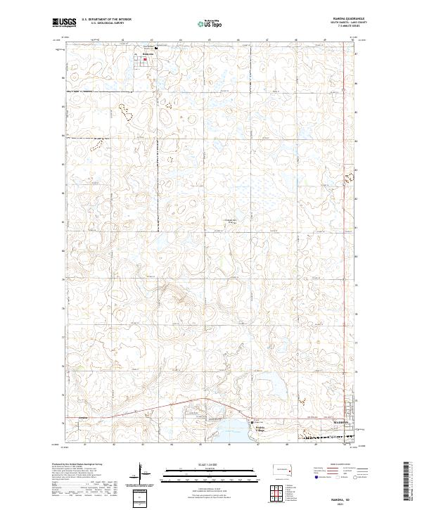
2021 Map of Ramona
USGS Topo · Published 2021About this map
Ramona serves as a primary settlement point on this Lake County landscape, situated within the distinctive geographic region of the Coteau des Prairies. The map documents a rural environment organized around an extensive grid of county highways and township roads, which connect localized landmarks such as Ramona Cem and Saint William Church Cem. This infrastructure reflects the agricultural heritage of the plains, where small communities like Junius and Prairie Village anchor the southern portion of the quadrangle.
Find a feature on this map
53 named features on this map. Tap any name to fly to it.
Don’t see what you’re looking for? This feature index may not catch every label — zoom into the map to look around manually.
Map Details
Editions of this 2021 Ramona Map
This is the sole edition of this map. No revisions or reprints were ever made.
Other maps of this area

1953 · Watertown
USGS Topo · 1:250,000

1955 · Sioux Falls
USGS Topo · 1:250,000

1958 · Sioux Falls
USGS Topo · 1:250,000

1958 · Watertown
USGS Topo · 1:250,000

1968 · Lake Madison
USGS Topo · 1:24,000

1968 · Ramona
USGS Topo · 1:24,000

1968 · Madison
USGS Topo · 1:24,000

1968 · Sinai
USGS Topo · 1:24,000

1968 · Lake Herman
USGS Topo · 1:24,000

1968 · Oldham
USGS Topo · 1:24,000