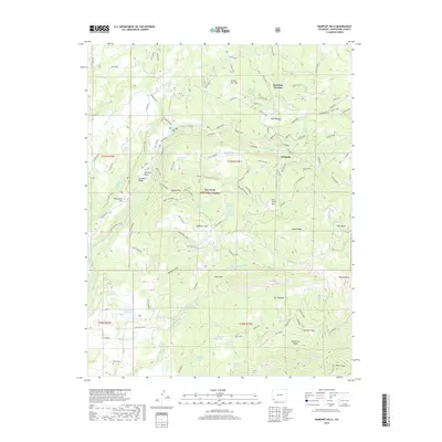
2019 Map of Rampart Hills
USGS Topo · Published 2019About this map
San Juan National Forest provides the backdrop for this look at the high-elevation water systems and historical settlements of eastern Montezuma County. The irrigation infrastructure is meticulously detailed, tracing the Turkey Cr Ditch, Crystal Cr Ditch, and the Jackson Gulch Inlet Canal as they move water across the complex terrain. The map captures several small centers of activity such as Golconda, Roundup Junction, and Millwood, while family legacies are preserved at the Sheek Cem. This landscape is defined by its water management, featuring a network of storage sites like Weber Reservoir, Menefee Reservoir, and Robbins Reservoir. Significant geographic landmarks include the distinctive Red Arrow Dome and Helmet Peak, which stand as prominent markers in this region of high ridges and deep basins.
Find a feature on this map
108 named features on this map. Tap any name to fly to it.
Don’t see what you’re looking for? This feature index may not catch every label — zoom into the map to look around manually.
Map Details
Editions of this 2019 Rampart Hills Map
This is the sole edition of this map. No revisions or reprints were ever made.
Other maps of this area

1895 · La Plata
USGS Topo · 1:62,500

1897 · La Plata
USGS Topo · 1:62,500

1897 · Rico
USGS Topo · 1:62,500

1898 · Rico
USGS Topo · 1:62,500

1899 · La Plata
USGS Topo · 1:62,500

1899 · Rico
USGS Topo · 1:62,500

1908 · La Plata
USGS Topo · 1:62,500

1956 · Cortez
USGS Topo · 1:250,000

1958 · Cortez
USGS Topo · 1:250,000

1959 · Cortez
USGS Topo · 1:250,000