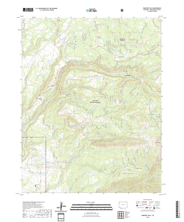
2022 Map of Rampart Hills
USGS Topo · Published 2022About this map
The San Juan National Forest encompasses the high country of Montezuma County, where a complex network of forest roads and irrigation ditches supports both timber and ranching. The landscape is defined by the Rampart Hills and The Hogback, featuring numerous named reservoirs such as Menefee Reservoir, Robbins Reservoir, and Box Canyon Reservoir. These water features, alongside the Weber Reservoir Inlet Ditch and Long Park Ditch, reflect a long-standing reliance on diverted water to sustain the lower-elevation flats and pastures.
Find a feature on this map
96 named features on this map. Tap any name to fly to it.
Don’t see what you’re looking for? This feature index may not catch every label — zoom into the map to look around manually.
Map Details
Editions of this 2022 Rampart Hills Map
This is the sole edition of this map. No revisions or reprints were ever made.
Other maps of this area

1895 · La Plata
USGS Topo · 1:62,500

1897 · La Plata
USGS Topo · 1:62,500

1897 · Rico
USGS Topo · 1:62,500

1898 · Rico
USGS Topo · 1:62,500

1899 · La Plata
USGS Topo · 1:62,500

1899 · Rico
USGS Topo · 1:62,500

1908 · La Plata
USGS Topo · 1:62,500

1956 · Cortez
USGS Topo · 1:250,000

1958 · Cortez
USGS Topo · 1:250,000

1959 · Cortez
USGS Topo · 1:250,000