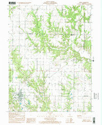
1998 Map of Ramsey
USGS Topo · Published 2002About this map
Ramsey Lake State Park and its surrounding water bodies dominate the southwestern portion of this Fayette County survey, where the village of Ramsey serves as a local hub. The landscape is defined by a dense network of tributaries including Ash Creek, Ramsey Creek, and Becks Creek, which carve through the terrain between the Oconee and Carson townships. This map captures a rural Illinois landscape where social and community life centered on several small rural congregations and burying grounds. Genealogists will find a high concentration of family-named landmarks and local burial sites, such as St Joseph Cem, Clark Cem, and Shed Cem. The map reveals the intersection of civil boundaries at the Shelby Co Fayette Co line, while the presence of Twin Churches in the east highlights the traditional settlement patterns of the late 20th century.
Find a feature on this map
23 named features on this map. Tap any name to fly to it.
Don’t see what you’re looking for? This feature index may not catch every label — zoom into the map to look around manually.
Map Details
Editions of this 1998 Ramsey Map
This is the sole edition of this map. No revisions or reprints were ever made.
Other maps of this area

1941 · St. Elmo
USGS Topo · 1:62,500

1942 · Shelbyville
USGS Topo · 1:62,500

1944 · Ramsey
USGS Topo · 1:62,500

1945 · St. Elmo
USGS Topo · 1:62,500

1946 · Shelbyville
USGS Topo · 1:62,500

1946 · Ramsey
USGS Topo · 1:62,500

1947 · Pana
USGS Topo · 1:62,500

1949 · Pana
USGS Topo · 1:62,500

1958 · Decatur
USGS Topo · 1:250,000

1961 · Decatur
USGS Topo · 1:250,000