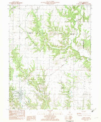
1982 Map of Ramsey
USGS Topo · Published 1982About this map
Ramsey Lake State Park and the village of Ramsey anchor this early 1980s landscape, where the Norfolk and Western rail line cuts diagonally across the prairie. The geography is defined by a series of branching waterways, including Becks Creek, Bolt Creek, and Ash Creek, which carve deep contours into the surrounding farmland. This transition from flat agricultural fields to the dissected timberline along the creek beds reveals the natural drainage patterns of northern Fayette County.
Find a feature on this map
23 named features on this map. Tap any name to fly to it.
Don’t see what you’re looking for? This feature index may not catch every label — zoom into the map to look around manually.
Map Details
Editions of this 1982 Ramsey Map
This is the sole edition of this map. No revisions or reprints were ever made.
Other maps of this area

1941 · St. Elmo
USGS Topo · 1:62,500

1942 · Shelbyville
USGS Topo · 1:62,500

1944 · Ramsey
USGS Topo · 1:62,500

1945 · St. Elmo
USGS Topo · 1:62,500

1946 · Shelbyville
USGS Topo · 1:62,500

1946 · Ramsey
USGS Topo · 1:62,500

1947 · Pana
USGS Topo · 1:62,500

1949 · Pana
USGS Topo · 1:62,500

1958 · Decatur
USGS Topo · 1:250,000

1961 · Decatur
USGS Topo · 1:250,000