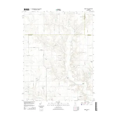
2015 Map of Ramsey Lake
USGS Topo · Published 2015About this map
Ramsey Lake and the winding valley of Ramsey Creek anchor this rural landscape where Montgomery, Shelby, and Fayette counties meet. The map reveals a dense network of family and community burial grounds, illustrating the deeply rooted history of the local farming population. From Tennessee Cem in the north to Nave Cem in the south, these sites are scattered across a terrain carved by numerous tributaries, including Hurricane Cr, Caesar Cr, and Liberty Cr. The geography is defined by narrow, wooded drainages such as Fox Hunt Hollow that cut through the agricultural tableland. A precise grid of county roads, such as E 2850 North Rd and 3300 North, provides access to these remote landmarks and connects the dispersed farmsteads of the Illinois interior.
Find a feature on this map
51 named features on this map. Tap any name to fly to it.
Don’t see what you’re looking for? This feature index may not catch every label — zoom into the map to look around manually.
Map Details
Editions of this 2015 Ramsey Lake Map
This is the sole edition of this map. No revisions or reprints were ever made.
Other maps of this area

1944 · Ramsey
USGS Topo · 1:62,500

1946 · Ramsey
USGS Topo · 1:62,500

1946 · Nokomis
USGS Topo · 1:62,500

1947 · Pana
USGS Topo · 1:62,500

1947 · Hillsboro
USGS Topo · 1:62,500

1949 · Hillsboro
USGS Topo · 1:62,500

1949 · Nokomis
USGS Topo · 1:62,500

1949 · Pana
USGS Topo · 1:62,500

1958 · Decatur
USGS Topo · 1:250,000

1961 · Decatur
USGS Topo · 1:250,000