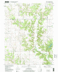
1998 Map of Ramsey Lake
USGS Topo · Published 2002About this map
Ramsey Creek and its many tributaries, including Elliott Creek and Caesar Creek, dominate this central Illinois landscape in the late 1990s. The map illustrates a deeply rooted rural society across the townships of Audubon, Hurricane, and South Hurricane. This area is notable for its high density of family and community landmarks, particularly country churches like Oak Valley Ch and New Bethel Ch, alongside numerous small burial grounds such as Tennessee Cem and Poland Cem. The presence of the Fairview Community Center suggests a localized social hub in an otherwise agricultural setting. To the southeast, the terrain shifts towards recreational use around Ramsey Lake, featuring a campground and boat ramp, providing a clear look at how the Fayette County landscape balances legacy farmsteads with state-managed conservation and parklands.
Find a feature on this map
36 named features on this map. Tap any name to fly to it.
Don’t see what you’re looking for? This feature index may not catch every label — zoom into the map to look around manually.
Map Details
Editions of this 1998 Ramsey Lake Map
This is the sole edition of this map. No revisions or reprints were ever made.
Other maps of this area

1944 · Ramsey
USGS Topo · 1:62,500

1946 · Ramsey
USGS Topo · 1:62,500

1946 · Nokomis
USGS Topo · 1:62,500

1947 · Pana
USGS Topo · 1:62,500

1947 · Hillsboro
USGS Topo · 1:62,500

1949 · Hillsboro
USGS Topo · 1:62,500

1949 · Nokomis
USGS Topo · 1:62,500

1949 · Pana
USGS Topo · 1:62,500

1958 · Decatur
USGS Topo · 1:250,000

1961 · Decatur
USGS Topo · 1:250,000