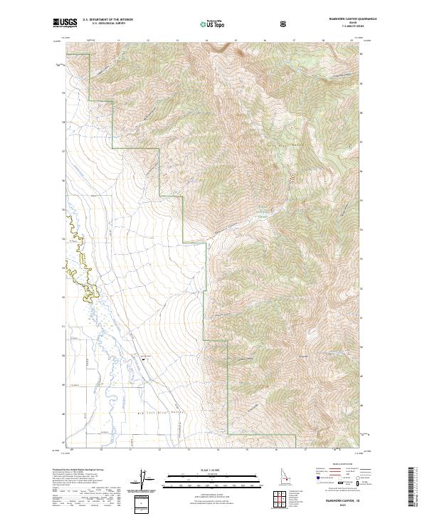
2023 Map of Ramshorn Canyon
USGS Topo · Published 2023About this map
Big Lost River Valley forms the dramatic centerpiece of this modern topographic study, where the valley floor meets the steep western face of the Lost River Range. The landscape is defined by its sophisticated irrigation network, designed to manage the waters of the Big Lost River through a series of engineered channels including Burnett Ditch, Island Ditch, and East Side Ditch. This reliance on water management is a hallmark of the region's agricultural footprint. To the east, the terrain rises sharply toward King Mtn and into the protected lands of the Challis National Forest. Notable for local history, the Pioneer Cem sits at the base of the mountains, a quiet marker of early settlement efforts along the canyon foothills. The map also traces the Rams Horn Canyon Trl as it winds through Ramshorn Canyon, providing a clear view of the transition from the river bottom to the high wilderness peaks.
Find a feature on this map
38 named features on this map. Tap any name to fly to it.
Don’t see what you’re looking for? This feature index may not catch every label — zoom into the map to look around manually.
Map Details
Editions of this 2023 Ramshorn Canyon Map
This is the sole edition of this map. No revisions or reprints were ever made.
Other maps of this area

1955 · Idaho Falls
USGS Topo · 1:250,000

1958 · Idaho Falls
USGS Topo · 1:250,000

1969 · Darlington
USGS Topo · 1:24,000

1969 · Arco Pass
USGS Topo · 1:24,000

1969 · Ramshorn Canyon
USGS Topo · 1:24,000

1969 · Howe NW
USGS Topo · 1:24,000

1969 · Sunset Peak
USGS Topo · 1:24,000
1969 · Methodist Creek
USGS Topo · 1:24,000

1972 · Arco North
USGS Topo · 1:24,000

1972 · Arco Hills
USGS Topo · 1:24,000